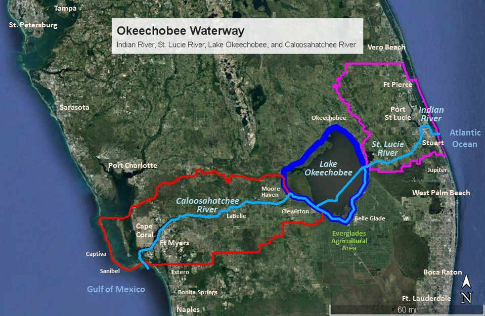
The Okeechobee Waterway begins in the Gulf of Mexico, proceeds along the Caloosahatchee River, crosses Lake Okeechobee, continues through the St. Lucie River then enters the Indian River before reaching the Atlantic Ocean. A million people live within its watershed. It is vital to the economies and drinking water supplies of south Florida and is the core of the region's flood control and drainage systems. Lake Okeechobee provides irrigation waters to a million acres of farm land along the rivers and within Everglades Agricultural Area.
Commercial and sport fishing, general recreation and tourism drive the economies of the estuaries and lake plus the adjacent Atlantic and Gulf beaches. Between irrigation, drainage, transportation, fishing, recreation, and tourism, the value of the Okeechobee Waterway is hundreds of millions of dollars. In addition, the watershed and waterways are habitat for endangered species (14 animals and 10 plants) plus another 14 threatened animal species.
The rivers of the Okeechobee Waterway are represented by three organizations:
Indian River Lagoon: Indian Riverkeeper www.indianriverkeeper.org
St. Lucie River: Rivers Coalition www.riverscoalition.org
Caloosahatchee River: Caloosahatchee River Citizens Association (Riverwatch) www.crca.caloosahatchee.org